Subway-Style Bike Path Map of Madison, WI
QGIS
Adobe Illustrator
What I learned
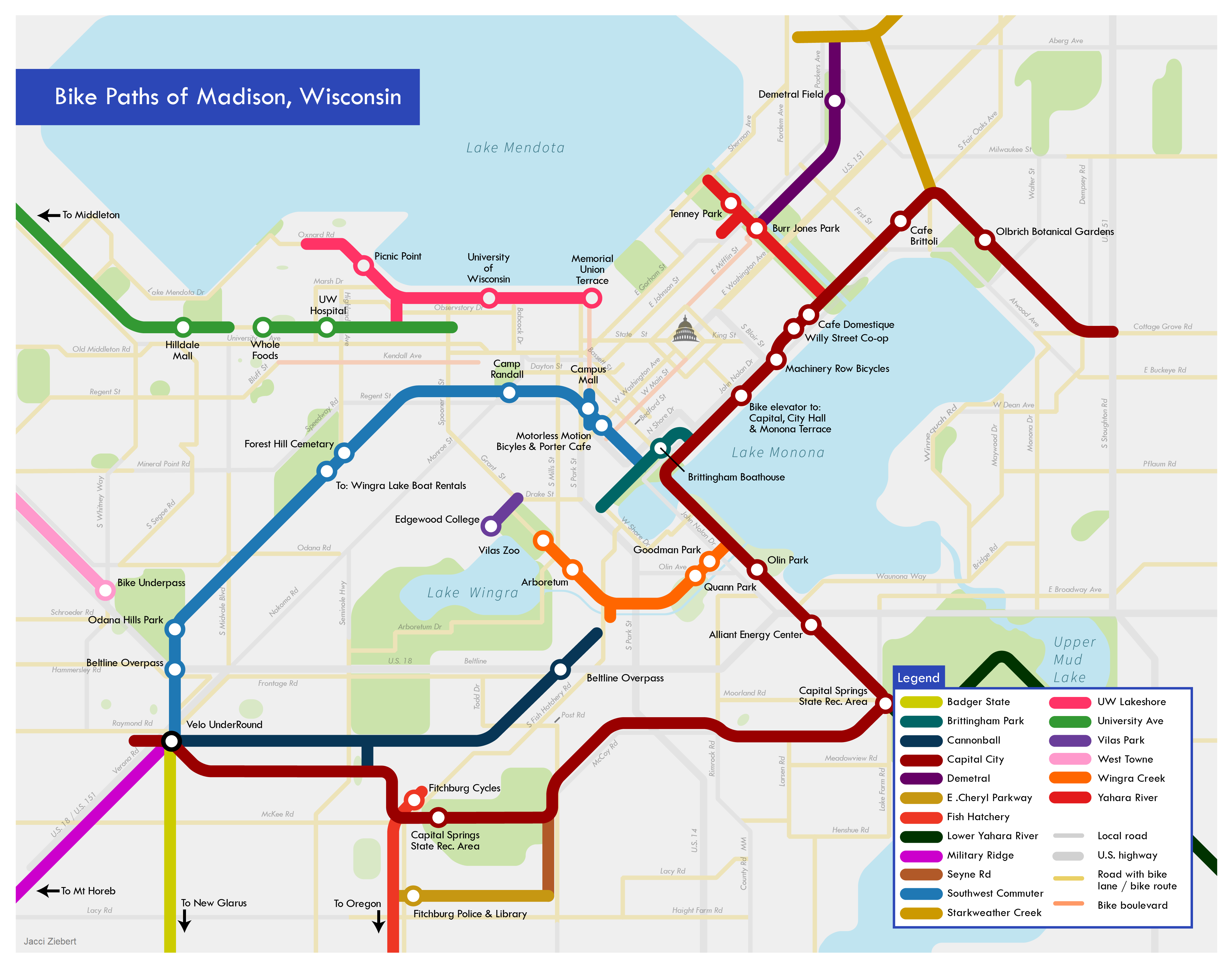
I wanted to combine my interests of biking and maps, so I made this map of my hometown of Madison, WI. I started off with using QGIS to get the streets via a TIGER shapefile. Then in Illustrator, I traced over these roads. As I wanted to maintain the subway style, the rule was that all lines and polygons had to use 45 degree angles.