Madison’s ‘Lost City’ - A Look Into the Failed 1920’s Lake Forest Development
This article was originally published on Reddit in 2016 and was even featured in The Capital Times.
A map geek, a planning enthusiast and a sucker for the unknown, I decided to delve a little deeper into one of Madison’s greatest mysteries, the “Lost City.” You may be thinking, “Is it even real?” or “Why the heck are there paved paths in the Arboretum?” After scoping out online resources, a visit to the Wisconsin Historical Society, and an in-situ visit to the area, I want to share what I found.
Let’s start with some context of planning. The industrial revolution brought an influx of people to flock to urban areas. By the late 1910s, it was the first time in human history that the country’s urban population outnumbered the rural population. This brought on the perception that cities were rifled with poor sanitation, terrible pollution, and overcrowding. Areas that were once used as public space or parks were now houses, businesses, and industries. People wanted to escape dirty, crowded cities, but did not want to live in farm country.
Starting in the 1890s and lasting til the 1920s, a new wave of planning cities emerged deemed the City Beautiful Movement. Led by developers, planners, and architects, the idea was that classic beauty and monumental grandeur of the city would inspire feelings of civic loyalty and moral rectitude. By incorporating civic centers, parks, and grand boulevards, city beautification would reduce crime, reduce density, and increase green space. While Madison was already established as being a pristine place to live, there were worries with what the city’s predicted continued growth will lead.
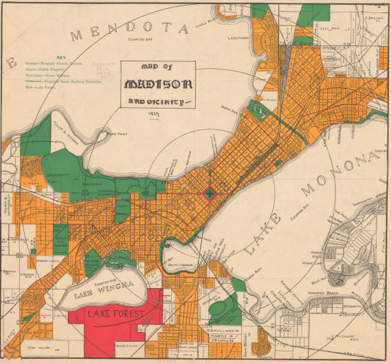
Developer and president of the Lake Forest Company, Chandler B. Chapman attempted to hop on the bandwagon in taking one step further in beautifying Madison by building a residential paradise called Lake Forest. An 800-acre epic development with over 1,000 lots, Lake Forest would be an escape from city life with numerous parks, its own public transit, and a city center. The company promoted Lake Forest by calling it “by far the best planned city residential section in Wisconsin” and “the most beautiful, modern, healthful, and desirable dwelling spot in the Northeast.”
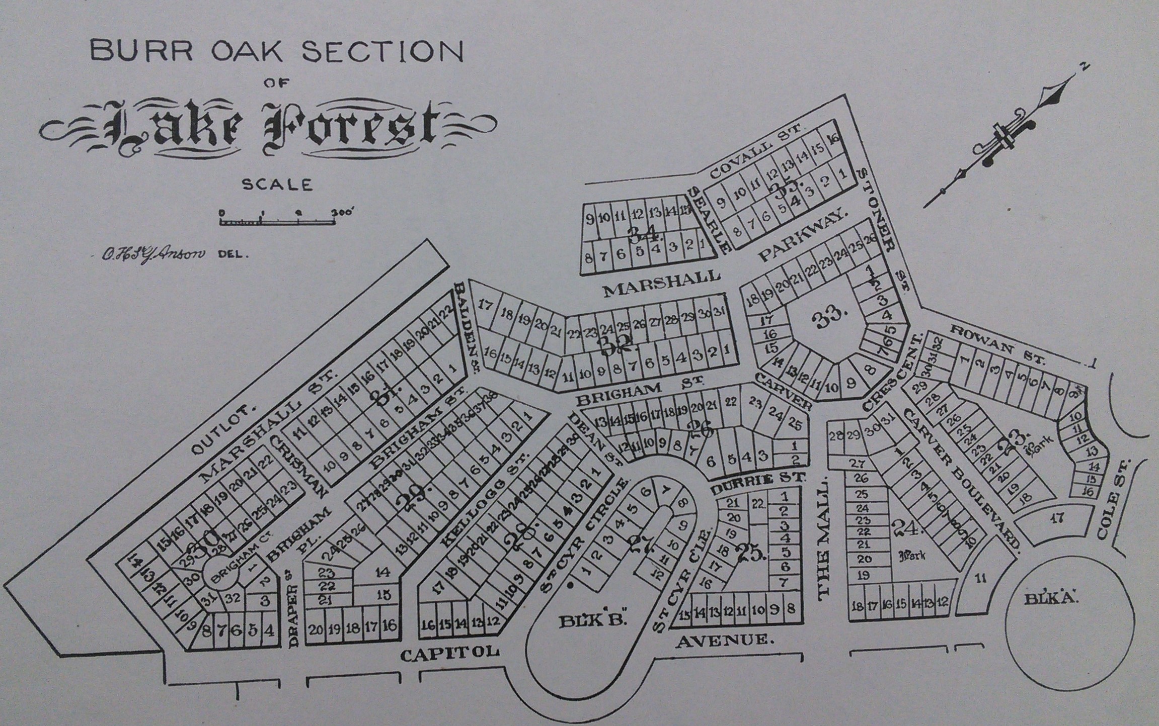
This southeastern section of the development was started with many of the roads built along with a few houses.
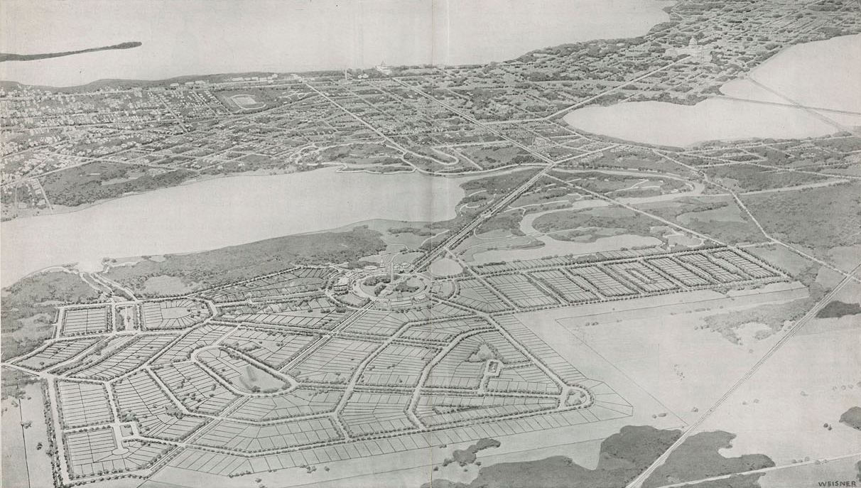
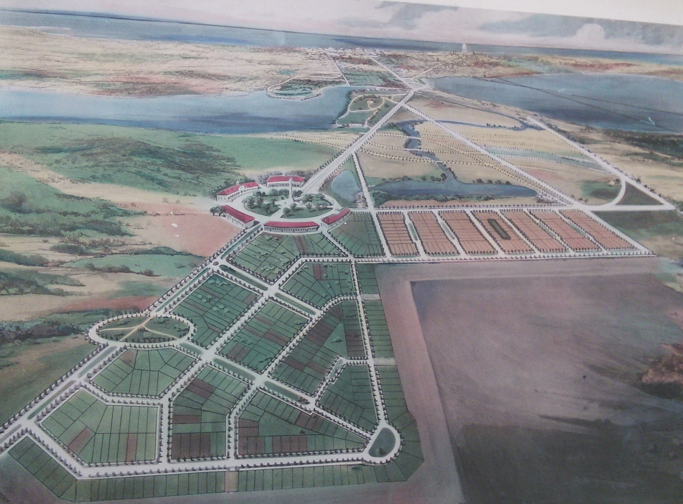
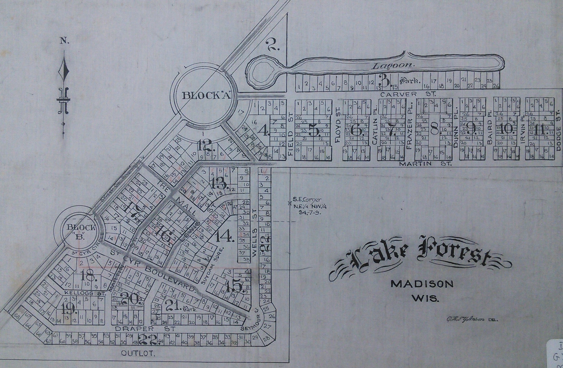 Note: Block A is the Civic Center and Block B is St. Cyr Circle while Capitol Avenue intersects these two circles.
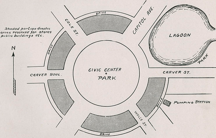
The center of life for Lake Forest residents, the Civic Center was planned to have small shops and businesses lined around the circle. Separating land uses, such as commercial, industrial, and residential, was a new phenomenon in planning. The only building still standing today is the pumping station which, I believe, is still in use.
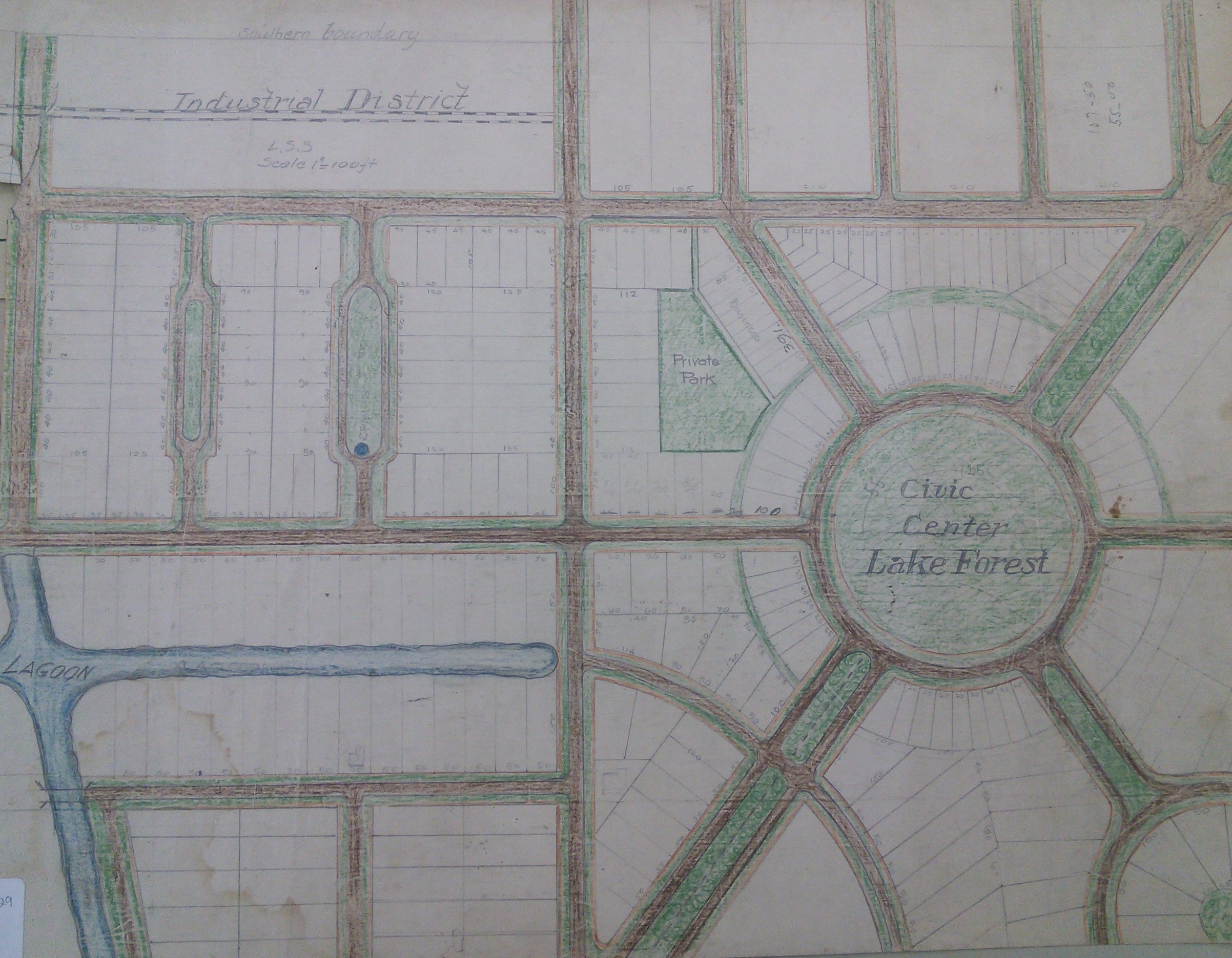
A network of lagoons were proposed for two prominent reasons: to provide waterfront access to residents and to stabilize the marshy grounds.
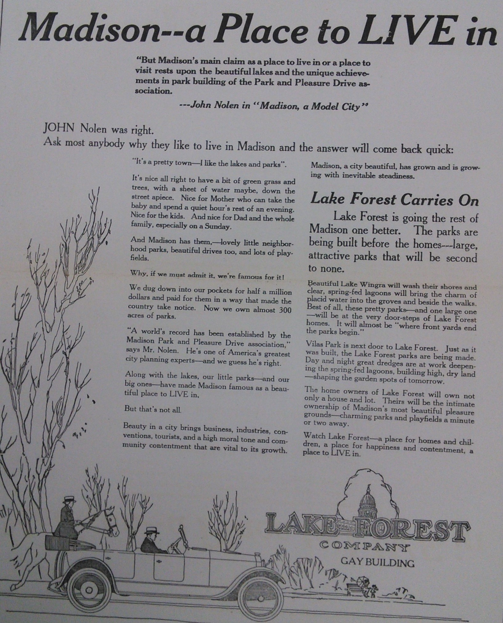
This was one grandeur development! To entice people in purchasing property, the company heavily advertised. Above is a 1920 advertisement placed in the Wisconsin State Journal. Additionally, a bimonthly newsletter called the “Lake Forester” that ran for 1.5 years from 1921-1922 was written to chronicle the progress of the development.
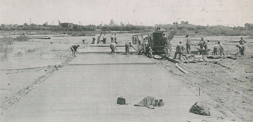
In 1921, the Lake Forest Company broke grounds: roads were pored with concrete, dredging was being done and housing foundations were laid. This is Capital Avenue under construction. Planned to be 120 feet wide with sidewalks on each side with an unforgettable view of the Capital Building, the size would have been comparable to Washington Avenue today. Street cars were planned to run in the center, providing transportation to the downtown. You can see St. Mary’s Hospital to the slight left.
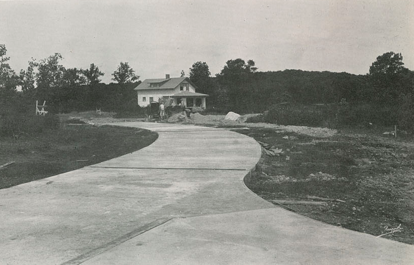
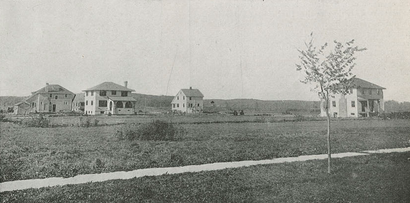
While at least five houses (some sources say 7 houses) were completed, none of them were ever occupied. EDIT: 10/8/2016 An Arboretum researcher says some of the houses are actually still standing and occupied.
What happened next, nobody foresaw. A combination of problems led to the collapse and eventual decay of the development. Dredging proved insufficient: roads and foundations were sinking due to marshy soils. In 1920, only 61 lots were sold while the company’s financial planner went bankrupt. The Great Depression and World War II didn’t help either. Strapped for cash, the Lake Forest Company sold some of the land to the University of Wisconsin for arboretum purposes in the 1930s. Ultimately the development failed. This area today is the Lost City Forest in the Arboretum, perhaps a different kind of paradise.
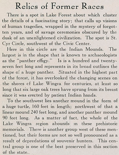
Yup, there’s actually Indian effigy mounds here! 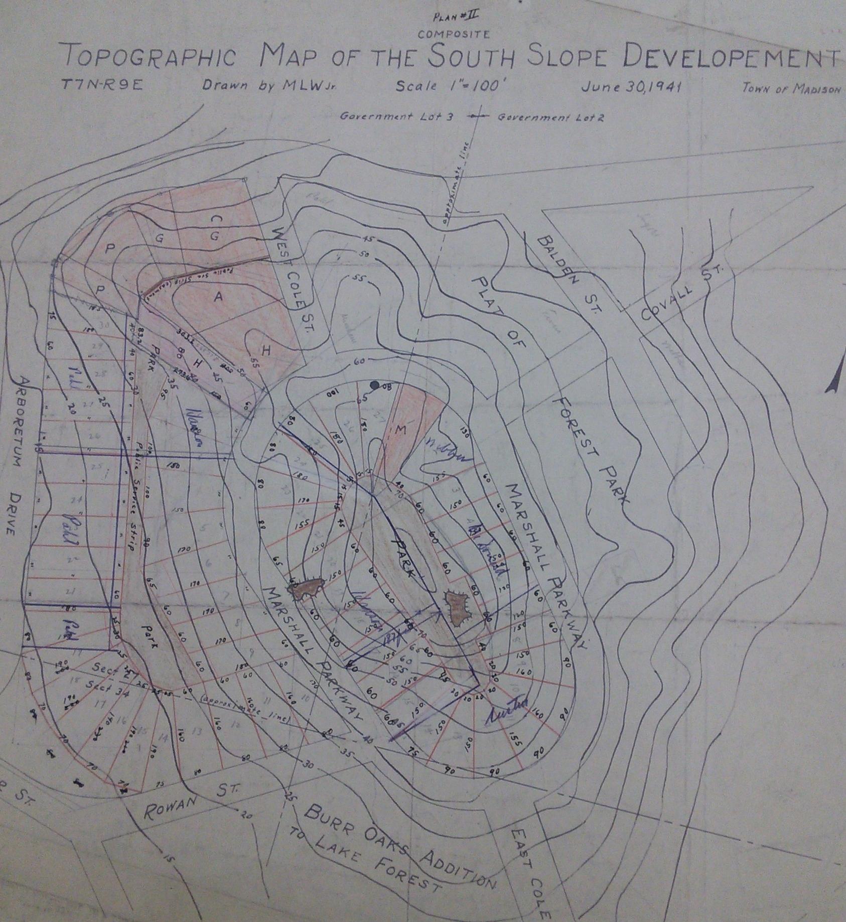 This 1941 plat map shows two effigy mounds located north of Lake Forest. Furthermore, a hand-drawn 1915 map of effigy mounds I found on Arboretum’s online map shows a group of four mounds here, one looking like a panther. Today this is now a residential area around Marshall Parkway. It’s private property and I wonder if the mounds still exist.
The mound site at St. Cyr Circle the article mentions, I found no records of a panther mound here. The 1915 map shows two long narrow mounds at this location while another map indicates that no mounds exist. However, there is a large group of at least 8 mounds located inside Wingra Woods, just west of Lake Forest.
A 1937 aerial photo of the area shows the remains of this epic development. As you can seen, only some of the roads were completed. Today the roads east of the former Civic Center is completely developed with houses and apartments, while the other roads remain crumbling into history.
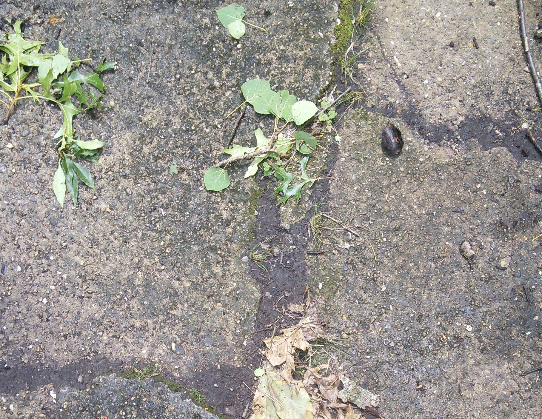
Today, not much remains. A walk into Lost City Forest you find mysteriously paved paths nearly a century old. If you look at the Imagery basemap at ArcGIS.com you could actually see outlines of these roads.
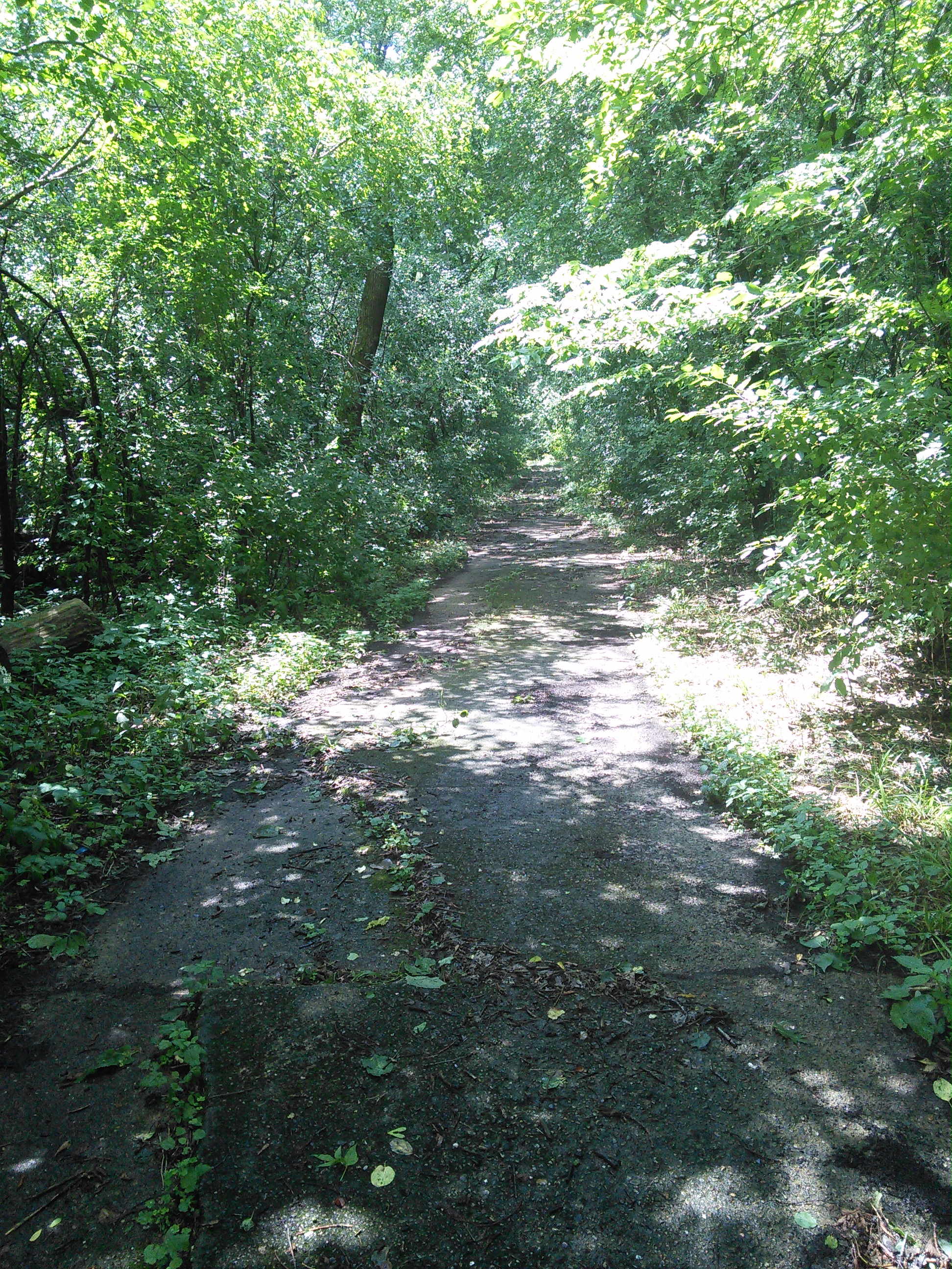 My findings cannot be complete without a stroll through the woods!
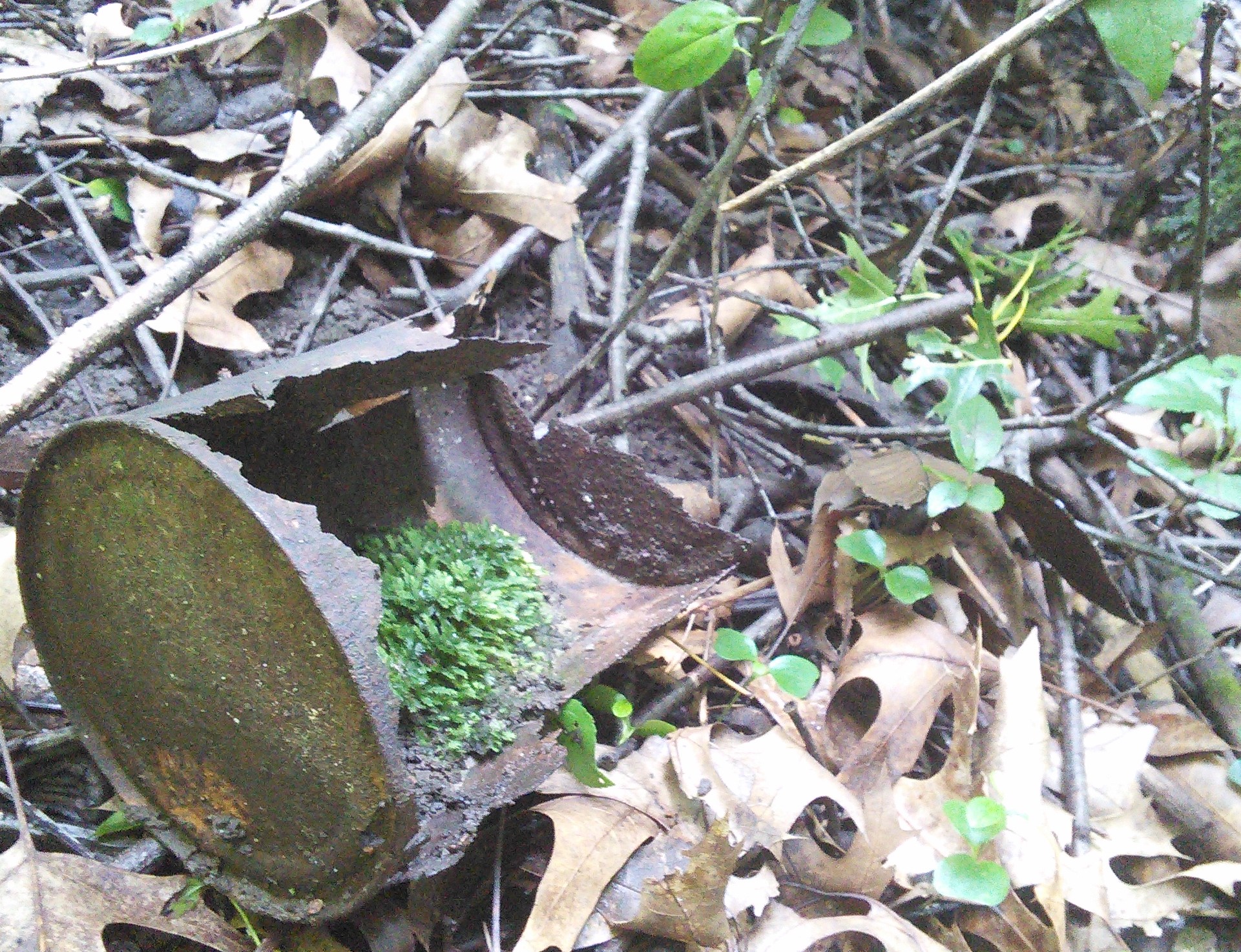
I bet some of you are tempted to look for the remains. The Arboretum hosts a once-a-year Lost City tour, typically at the end of October. I went to the presentation and I highly recommend it.
The Arboretum advises hikers to not wonder off the trails as to protect the environment. I don’t want to encourage nor discourage people from doing so, just wanted to share a piece of this fascinating mystery.
If you’re curious, a few adventurers sought to find the Lost City. Check ’em out here:
- https://badgerherald.com/artsetc/2015/09/14/madisons-lost-city-inside-the-forgotten-remains-of-lake-forest/
- http://never365.blogspot.com/2013/11/day-177-finding-lost-city.html
- https://www.youtube.com/watch?v=GpYXDLR4_f0&feature=youtu.be
Hope you enjoyed this!
Sources:
- ArcGIS Online
- Lake Forester, 1920 - 1921 found at University of Wisconsin Collection
- Madison:the illustrated sesquicentennial history Vol. 1 1856 - 1931
- Wisconsin Historical Aerial Image Finder
- Wisconsin Historical Society